
Geography
-
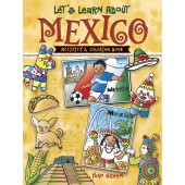
Let's Learn About MEXICO: Activity and Coloring Book
SKU: 1733
$5.99Head south of the border to explore a sunny world of puzzles and fun facts! Welcome to Mexico, land of tropical rain forests, volcanoes, deserts, and beaches — and a vibrant array of ancient and modern traditions. This book introduces kids ages 6 to 10 to fascinating aspects of Mexican geography, language, food, arts, sports, and festivals. Puzzles and activities range from dot-to-dots, crosswords, and spot-the-differences to easy directions for making piñatas and maracas. Cute illustrations offer plenty of opportunities for coloring. Dover Original. Learn More -
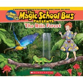
Magic School Bus presents the Rain Forest
SKU: 7795
$7.99The Magic School Bus Presents the Rainforest stars Ms. Frizzle and her class and explores the plants and animals of our planet's rainforests.
The bestselling Magic School Bus series has taught thousands of kids about everything from oceans to space to dinosaurs. The Magic School Bus Presents the Rainforest will expand upon the original titles with fresh and updated content about all of the incredible plants and animals that live in the world's rainforests. With vivid full-color photographs on each page as well as illustrations of the beloved Ms. Frizzle and her students, the Magic School Bus Presents series will enthrall a whole new generation of Magic School Bus readers.
Learn More -
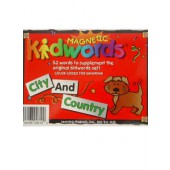
Magnetic Kidwords®-City & Country Magnets
SKU: 3455
$8.99Use these 52-piece Kidwords thematic sets to further expand your children's word choices. This set includes words that pertain to cities and countries. Add a Kidboard or magnetic E-Race Away dry erase board for hours of learning fun. Ages 5+ Grades K and up. Other sets available. Ages 5+, Grades K and up WARNING: CHOKING HAZARD - Small parts. Not for children under 3 yrs. Learn More -
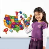
Magnetic U.S. Map Puzzle
SKU: 5884
$27.49This fun, interactive puzzle map will help little learners learn geography-state names, landmarks, plants, animals and more! Each of the 44 pieces matches an outline to help children put the correct piece in the correct spot. Great for working on fine motor skills. Measures 19”L x 13”H when complete.
Educational Benefits:
• Learning Style:Visual, Tactile
• Skill Development: Geography, Critical thinking, Spatial relationships, Fine motor skills Includes
• 44 magnetic pieces, paper map outline
• Measures 19”L x 13”H when complete
• Age 4+ • Grade PreK+
From Learning Resources
Learn More -
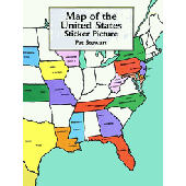
Map of United States Stickers
SKU: 4861
$7.99Complete a map of the U.S. by applying sticker illustrations of 50 states and their capitals to a laminated background. The fun-filled learning aid includes 3 sets of clues for identifying states: names, colors, and shapes. For pre-schoolers and older. 44 full-color stickers. Learn More -
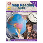
Map Reading Skills Resource Book Grade 5-8
SKU: 6426
$11.99Get your GPS going with students in grades 5–8 by using Map Reading Skills! The activities in this 80-page book provide students with ample opportunities to practice and apply map skills. Map and diagram exercises and hands-on activities reinforce skills. This book includes reproducible maps and a special section on GPS and its uses, and it highlights essential vocabulary in bold. The book aligns with state, national, and Canadian provincial standards.
Learn More -
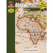
Map Skills - Africa
SKU: 10232
$19.95Explore the varied features of the African continent while reinforcing basic map reading skills. Sixteen student pages and accompanying blackline and full-color maps coordinate to provide a relational study of the elevation, vegetation, products, population, and peoples of Africa. Full-color maps are provided as transparencies for print books and PowerPoint slides for eBooks. Student pages challenge students to combine maps and additional resources in order to answer questions and make judgments. Question topics follow the Five Themes of Geography as outlined by the National Geographic Society: finding absolute and relative locations on a map, relating physical and human characteristics to an area, understanding human relationships to the environment, tracing movement of peoples and goods throughout an area, and organizing countries and continents into regions for detailed study. Grades 7-9. 36 Pages. Learn More -
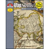
Map Skills - Asia
SKU: 10233
$19.95Explore the varied features of the Asian continent while reinforcing basic map reading skills. Sixteen student pages and accompanying blackline and full-color maps coordinate to provide a relational study of the elevation, vegetation, products, population, and peoples of Asia. Full-color maps are provided as transparencies for print books and PowerPoint slides for eBooks. Student pages challenge students to combine maps and additional resources in order to answer questions and make judgments. Question topics follow the Five Themes of Geography as outlined by the National Geographic Society: finding absolute and relative locations on a map, relating physical and human characteristics to an area, understanding human relationships to the environment, tracing movement of peoples and goods throughout an area, and organizing countries and continents into regions for detailed study. Grades 7-9. 36 Pages. Learn More -
Map Trek: U.S. Edition Atlas and Outline Maps of World History CD ROM
SKU: 4367
$19.95106 Full-color teacher answer maps. 106 Blank outline maps for the student. Instructions for how to use these maps 53 Historical maps 50 State maps Lesson Plans 3 Full US maps (different sizes) 242 total pages Learn More -
Maps & Globes
SKU: 3871
$8.99This comprehensive look at geography and the environment, Maps and Globes, can take you anywhere—to the top of the tallest mountain on earth or the bottom of the deepest ocean. Maps tell you about the world: where various countries are located, where the jungles and deserts are, even how to find your way around your own hometown. If you take a fancy to any place on earth, you can go there today and still be home in time for dinner. So open a map, spin a globe. The wide world awaits you. 48 pages. Paperback. Ages 4-8. Supports the Common Core State Standards Learn More -
Maps for U.S. History Grades 5-8
SKU: 0843
$13.99Enhance history lessons with visual aids that keep students focused and motivated. Maps for U.S. History for grades 5 to 8+ provides clear, detailed maps that highlight historic events so that students can feel a connection between the past and present. Perfect for illustrating history lessons, this supplement enhances the learning process and keeps students’ attention. This collection ranges from early native civilizations to the wars of the nineteenth century, and so much in between! Grades 5-8. 128 Pages. From Carson-Dellosa. Learn More -
Maps of the U.S.A. Grades 1 - 6 Evan-Moor
SKU: 12742
$21.99This fascinating book contains magnificent reproducibles for a study of American history or geography.
Each state includes a page with the state bird, flower, nickname, area, population, admission date and flag, while the facing page contains a map of the state with places to visit and "Did you Know?" trivia.
A mini-map of the USA in the corner shows where the state is within the US.
Seven regional maps, along with political, climate, physical, time zone and more maps are included.
128 reproducible pages, softcover.
Grades 1-6.
Recommended ages 6 and up.
Learn More -
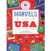
Marvels of the USA Activity Book
SKU: 4258
$9.99Author: Claire Saunders
Illustrator: Neil StevensFeaturing a showcase of the astounding sights that the US has to offer, Marvels of the USA offers games such as a Great Prismatic Hot Spring color-by-numbers, a Central Park spot-the-difference, and an Indianapolis word search. The engaging puzzles are sure to keep kids entertained for hours.
Learn More -
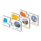
Match It! States & Capitals-The Learning Journey
SKU: 1931
$14.99This colorful set of two-piece puzzle cards features the 50 States of the United States of America. Help your child learn to recognize the State and its capital. Simply match the shape of the State to its name and capital. They also feature a picture of the State’s Capitol Building. The puzzles are self-correcting as no two puzzle cuts are the same. Match It! States and Capitals is a great way to quiz your kids on their US geography! Includes 50 two-piece puzzle cards. Ages 4-7. Learn More -
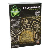
Maya Discover Dig Kit
SKU: 0284
$11.75Your adventure kit will take you back over 2,000 years to the wolrd of Maya...a civilization rich in temple-pyramids, observatories and hieroglyphics. Become an archaeologist and unearth buried treasures from the Mesoamerica era. Get ready, set...Explorer-U!
Learn More -
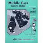
Middle East Country Studies
SKU: 0078
$13.95This book will teach students about the Middle East and the countries through the use of reproducible maps, facts, and history. Grades: 4th, 5th, 6th, 7th, 8th. Individual Outline Map & Questions to Answer for Each Country. Classroom Reproducible with Bonus Activities. Answer Key & Teacher Instructions. Learn More
-
Mighty Maps!
SKU: 10238
$12.95Facts, Fun and Trivia to Develop Map Skills, Teach students the language of maps and watch them discover the world! Here are the basics of reading maps along with using a compass; reading latitude and longitude; drawing map symbols; using time zone maps and understanding political, physical, road, city, weather, product maps and much more. Following directions today will prepare your students for travel! Grades 3-6. 96 pages. Learn More -

My Own State Book
SKU: 4491
$2.99Students will be proud to have their very own books, and teachers will love watching their progress! My Own State Book is the perfect complement to any state study unit. Students can record and illustrate facts about their state symbols, government, industry, historical events, flora and fauna, and more. A ready-to-color cover adds to the fun.
Learn More -
myWorld Interactive Geography Homeschool Bundle Grades 6-8
SKU: 1270
$149.00The bundle includes: Student Edition Textbook 1-year student and teacher digital access to SavvasRealize.com, our award-winning online learning platform Learn More -
National Parks Coloring Book
SKU: 7511
$6.99Congress established Yellowstone, the nation’s first national park, in 1872. Today there are 50 national parks within the United States, encompassing an extraordinary diversity of terrain, animal life, and vegetation. From the dry deserts of Big Bend National Park in Texas to the icy wilderness of Gates of the Arctic National Park in Alaska, the wonderful natural heritage of America’s national parks is yours to color and enjoy in this exciting coloring book. Among the other parks features are Grand Canyon, Everglades, Great Smoky Mountains, Mammoth Cave, Petrified Forest, and many more. In addition to Peter Copeland’s detailed, carefully researched drawings, you’ll also find informative captions describing distinguishing features of each park, its wildlife, plants, and available activities for visitors. The result is not only an enjoyable and informative coloring book, but also a useful survey of the major attractions of these splendid preserves. Dover Original. Learn More -
North America (The Seven Continents) Evan-Moor
SKU: 12734
$21.99Develop geography literacy while learning about the unique characteristics of North America!
The 7 Continents: North America helps students learn about North America through engaging reading and writing activities.
Five geography units cover the following standards-based topics: North America in the World, Physical Features of North America, Valuable Resources of North America, and North American Culture.
Recommended ages 9 and up.
Learn More -
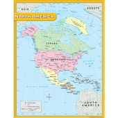
North America Map Chart
SKU: 1303
$5.99Convenient, useful learning tools that decorate as they educate! Each chart measures 17" by 22". Related lessons and activities are provided on the back of every chart.
Learn More -
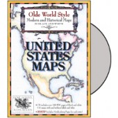
Old Worlde Style Maps: United States Maps CD
SKU: 7023
$19.95The United States Maps set contains maps of each state, Washington DC, and over a dozen maps of American History. The state maps are offered three ways for your convenience: with labels, without labels, and in outline form. Use the labeled version for simply coloring, or have your student do their own labeling! Or, get more specific by designating areas of agriculture, locations of historic landmarks, displaying reservations, and much more! Also included are over a dozen maps pertaining to the growth and changes of the Nation. From the location of various Native Tribes to the 13 Colonies, and through the expansion of the states, these maps will offer additional helps when studying America's history.
BONUS! Also included are Fact Sheets for each state for the student to fill out and color in. Teacher keys are provided, as well as a set of state flags in full color to cut out and adhere to the sheet!
The set contains PDF pages for maps and Notebook Pages, provided individually and in limited groupings for your printing convenience. These Maps are designed to accompany your studies. Tips for use are included, however no lesson text is provided. From Homeschool in the Woods. Suggested Grades K-12.
Learn More -
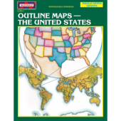
Outline Maps: The United States Reproducible Workbook
SKU: 8057
$5.99This book contains a variety of outline maps of the United States and its regions, along with activities that focus on borders, capitals, landforms, population, bodies of water, and more.
6th - 9th Grades
24 pages
From Teacher Created Resources
Learn More -
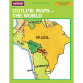
Outline Maps: The World Reproducible Workbook
SKU: 12101
$5.99Here are super activities that teach students the names and locations of various places in the world. The main focus is on natural land features, bodies of water, countries, regions, and continents.
6th - 9th Grades
24 pages
From Teacher Created Resources
Learn More